Historypin is a website that allows users to view and post historical photos that have been digitally “pinned” to a map– thereby highlighting the location which may be unrecognizable in the photo. It allows photographs to be searched by place, time, or channel– channels are accounts that have been set up by various people and organizations.
We created our channel on Historypin– UCSF Archives & Special Collections— in part to begin celebrating the 150th anniversary of UCSF! Toland Medical College began in 1864 in the heart of San Francisco’s North Beach neighborhood, moved to the wide-open countryside of the Parnassus/Inner Sunset area, and has continued to change and grow.
We will continue to add images and information throughout the coming year. Check back often for new and interesting images of the ever-evolving UCSF campus. We encourage you to add comments or information to our pinned images!
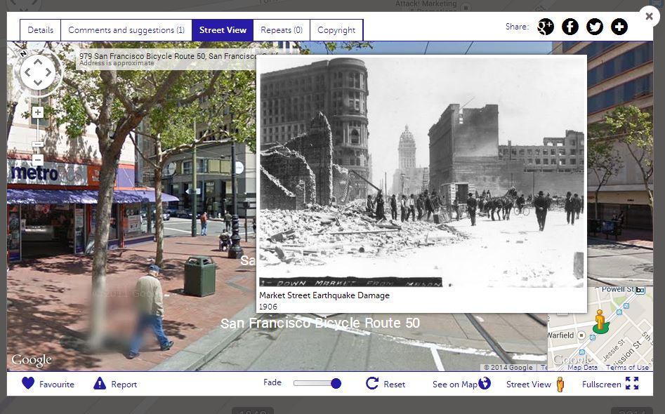
One of the niftiest features of Historypin is the ability to pin an image directly onto street view. If the photograph was taken from the street (or similar angle and location), it can be placed on the map over the Google street view image of the image’s location– just like the image of Market Street Earthquake Damage, 1906 shown below. You can toggle the fade slide bar to play with photograph’s opaqueness.
For more detailed information on the history of UCSF, please see A History of UCSF.